The vessel’s activities in Venezuelan waters were captured by two commercial satellite providers. Images dated Nov. 14 show the Skipper berthed at the José Oil Terminal loading crude. Separate imagery taken Nov. 18 confirms the tanker at the same terminal, a major hub for Venezuela’s state-run oil exports. Kpler analyst Matt Smith told ABC News the shipment totaled approximately 1.1 million barrels of heavy sour Merey crude and was conducted with the transponder switched off—a tactic the industry labels “dark activity.”
Continuous satellite coverage between Oct. 30 and Dec. 4 further documented the ship remaining off Barcelona while its AIS broadcast placed it elsewhere. The discrepancy supports assessments that the vessel purposely transmitted false coordinates to mask sanctioned trade.
Totaling roughly 274 meters in length, the Skipper had already attracted U.S. scrutiny. In 2022 the Treasury Department’s Office of Foreign Assets Control sanctioned the vessel—then sailing as Adisa—and its registered owner, Triton Navigation Corporation, for alleged links to Hezbollah and Iran’s Islamic Revolutionary Guard Corps-Qods Force. The sanctions listing, available on the Treasury’s OFAC website, freezes any U.S.-related assets and bars American entities from doing business with the designated parties.
Corporate records on the MarineTraffic database, a platform owned by Kpler, list Triton Navigation as the registered owner and Thomarose Global Ventures as the beneficial owner. Shipping databases show the vessel sails under a Liberian flag, a registry often used by commercial operators seeking tax or regulatory advantages.
Historical satellite analysis by TankerTrackers.com outlines an extensive 2025 voyage pattern that includes multiple sanctioned jurisdictions. According to the firm, the Skipper loaded 1.87 million barrels of Iranian crude bound for China in February and transported another 1.95 million barrels along the same route in July. Imagery places the ship off Iran and China between March and September before it rounded the Cape of Good Hope, appeared near Madagascar in October, and crossed the Atlantic.
The first indication of its approach to Venezuela emerged Oct. 29, when satellite data showed the tanker north of Trinidad and Tobago on a south-westerly course. By the following day, images placed it off Barcelona, where it remained for more than five weeks, reportedly taking on cargo without broadcasting an accurate location.
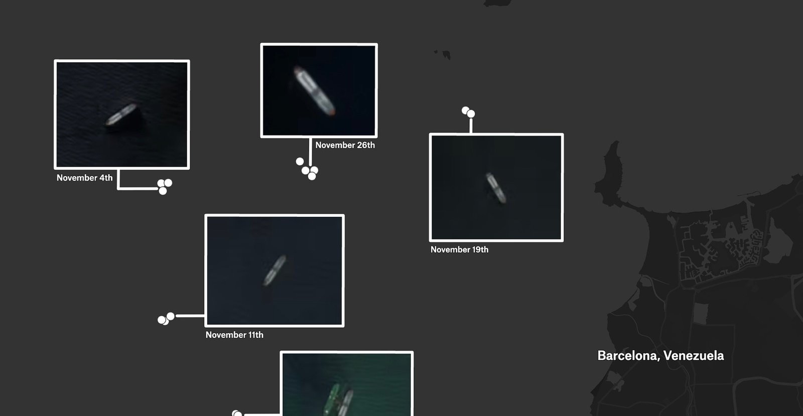
Imagem: Internet
Industry analysts note that spoofing alone does not hide a vessel from space-based sensors but can complicate enforcement by creating confusion in real time. “Satellite imagery ultimately reveals the truth, but false AIS tracks can delay detection and allow cargoes to change hands,” said a senior maritime compliance official familiar with the investigation.
The U.S. seizure Wednesday was carried out by federal law-enforcement agents aboard U.S. Coast Guard assets operating near Venezuelan waters, according to four individuals briefed on the matter. Details of how the operation unfolded have not been released, though officials confirmed the boarding followed coordination among multiple agencies monitoring sanctions compliance.
Legal proceedings will determine the disposition of both the vessel and its cargo. Under U.S. sanctions statutes, proceeds from illicit shipments can be directed to the Treasury’s forfeiture fund, while the ship itself may be subject to sale or dismantling if courts affirm the government’s claims.
The Skipper’s crew, reported to be mostly Indian nationals, was being interviewed by authorities as of Thursday. No charges against individual sailors had been announced.
The incident underscores the continuing cat-and-mouse dynamic between sanctions enforcement bodies and maritime operators. Analysts expect U.S. agencies to increase reliance on commercial satellite imagery, radio-frequency mapping, and advanced data analytics in an effort to detect similar schemes.
Crédito da imagem: TankerTrackers.com / Copernicus Sentinel / Planet Labs PBC


