Meteorologists warn that the scenario resembles past long-duration Caribbean hurricanes that generated catastrophic impacts. Should Melissa reach the Category 4 threshold now projected, it could deliver the most severe hurricane conditions Jamaica has experienced since Hurricane Gilbert in 1988.
Timeline of expected impacts
Saturday: Hurricane-force winds are expected to arrive in southern Haiti during the day, spreading toward Jamaica Saturday night.
Sunday: Major-hurricane conditions likely across Jamaica, especially the eastern and southern parishes, with the core of strongest winds remaining nearby into Monday.
Monday–Tuesday: The system is forecast to creep west or west-northwest, maintaining major-hurricane status while lingering near or just south of the island.
Confidence in this prolonged impact window has increased during successive forecast cycles, according to hurricane specialists. Residents across the region are urged to finalize preparations, secure property and follow directives from local emergency agencies.
Rainfall and flooding threats
Melissa is a large storm capable of drawing deep tropical moisture over mountainous terrain. Current rainfall projections call for 15–25 inches across southwestern Haiti and eastern Jamaica through Monday, with isolated totals exceeding 30 inches possible where persistent rainbands train over the same locations. Elsewhere in Haiti and the southern Dominican Republic, 6–12 inches are expected.
These amounts are likely to trigger life-threatening flash floods and numerous landslides, particularly in areas with steep slopes or poor drainage. Emergency managers emphasize that flooding often proves more deadly than wind during slow-moving tropical systems.
Casualties and early damage
Even before reaching hurricane strength, Melissa has claimed at least one life. Authorities in Haiti reported that an elderly man was killed by a falling tree as squally weather associated with the outer circulation swept the countryside. Additional injuries and property damage are possible as the storm’s intensity increases and hazards expand.
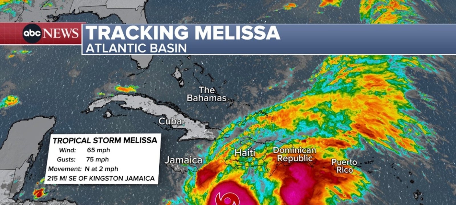
Imagem: Internet
Historical context
If Melissa maintains major-hurricane intensity while skirting or striking Jamaica, it would mark the strongest land-impacting storm there in more than 35 years. Hurricane Gilbert, also reaching Category 4, devastated the island in September 1988 with estimated winds near 135 mph and widespread structural damage.
While every cyclone evolves differently, comparisons to Gilbert underscore the importance of heeding official warnings. Modern building codes and improved early-warning systems have reduced vulnerability, yet many communities remain exposed to prolonged power outages, blocked roads and limited access to clean water.
Preparedness actions under way
Government agencies in Jamaica, Haiti and the Dominican Republic have issued tropical storm and hurricane watches for coastal provinces. Shelters are being readied, and relief supplies are being positioned for rapid deployment. Airports and seaports may close temporarily as squalls intensify, and travelers are advised to monitor carrier updates.
Residents in low-lying areas are encouraged to relocate before roads become impassable. Officials also recommend securing loose outdoor items, trimming overhanging branches and stocking essential medications, food and water for several days.
Outlook beyond the Caribbean
Long-range guidance suggests Melissa could eventually turn northward toward the western Atlantic late next week, but uncertainty remains high. Steering currents will depend on the evolution of a mid-latitude trough forecast to dig over the southeastern United States. For now, forecasters are focused on the immediate Caribbean threat.
Real-time updates, advisories and forecast maps are available from the National Hurricane Center, which issues bulletins every six hours—or more frequently as conditions warrant.
Crédito da imagem: ABC News


